|
| Electoral Atlas of the Dominion of Canada (1895) |
 |
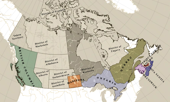
This site provides access to the first set of detailed maps prepared by the Canadian government to show federal electoral boundaries. Most of the electoral districts described in this 1895 atlas are identical to the 1901 census districts.
* The Electoral Atlas of the Dominion of Canada (published in 1895) did not include electoral maps of Yukon Territory or the North-West Territories (which comprised the Districts of Saskatchewan, Alberta, Assiniboia, Athabasca, Franklin, Keewatin, Mackenzie, and Ungava). Detailed electoral maps of Yukon Territory and the organized districts of the North-West Territories (i.e., the Districts of Athabasca, Alberta, Saskatchewan, and Assiniboia) were, however, published in subsequent editions of the atlas, the first of which appeared in 1906. |
|
|